Showing posts with label trails. Show all posts

Monday, December 22, 2025

85-Mile Grand River Greenway Project On Track

Events Calendar

Grand River Greenway
Grand River Greenway in Grand Rapids (photo from the Grand River Network)

compiled from various sources

Three decades ago, leaders in Ottawa and Kent Counties, Michigan, envisioned a trail that would follow the Grand River from Lowell to Lake Michigan. The Grand is Michigan's longest river at 252 miles.

An overall vision for what this project could be, and long-range planning are bringing the concept closer to reality. The Grand River Greenway is not one single project. Multiple partners are working together to connect individual segments to create a continuous pathway.

Several segments are currently under construction or are recently completed.

The Bayou Segment of the Idema Explorer Trail in Grand Haven is open, including a 14-foot-wide, multi-use pedestrian bridge over Stearns Bayou. “This will complete a 13-mile-long route from the end of the Grand Haven pier to Riverside Park, connecting several Greenway parks together while also establishing the longest continuous section of the trail to date,” said Ottawa County Parks and Recreation Commission President Kelly Rice.

Work has continued on the Bass River Segment from Riverside Park in Robinson Township to the Bass River State Recreation Area in Allendale Township. This portion of the greenway is in progress and will be 7.4 miles long.

The Eastmanville Connector Segment continues another 3 miles to the east, and has been funded by the Natural Resources Trust Fund.

By the end of 2026 several portions and related projects are expected to be complete:
• New trail connections in Kent County from White Pine Trail State Park to downtown Ada
• New trail connections in Ottawa County to and through Bass River State Recreation Area
• Expanded year-round recreational amenities at Johnson Park
• Dam removal and habitat restoration in the Grand River to restore the rapids. Sea lamprey barriers will be installed
• New river access and public space in the Market Avenue corridor of downtown Grand Rapids
overview map of Grand River Greenway
overview map of the Greenway (from the Grand River Greenway Framework for Vision and Action)


$150 million of work will be completed in 2026, funded by both public and private dollars, including American Rescue Act funds, the Land and Water Conservation Fund, the Natural Resources Trust Fund, and philanthropic donations.

The full Grand River Greenway project is expected to be completed by 2031.


See the Grand River Greenway Framework for Vison and Action, a pdf


These links are checked on the date of the article. As the article ages, some links may become invalid

Go To www.getoffthecouchnews.blogspot.com for all the news
See Get Off The Couch


Friday, December 12, 2025

Former Scout Camp Greilick Open to Public

Events Calendar

ski trail sign
Camp Greilick ski trail (photo from Grand Traverse County)

compiled from several sources, mostly from a news release of Grand Traverse County

After Over 1,000 hours of volunteer time, plus work from staff and community partners, Camp Greilick near Traverse City, Michigan, is now open to the public. Four-season activities are available.

Featured are: A hiking trail called Lagoon Loop, additional trails for hiking, snowshoe, backcountry cross country skiing, an 18-hole disc golf course, “Wood Chip Hill” children’s area with story walk and bouldering wall and two geocaches.

The overarching park vision is to protect and preserve the conservation value of the property and dedicate it as a public space where county residents and visitors can experience passive and active outdoor recreation, learn to be better stewards of the environment, and develop skills to improve their outdoor experience.

Grand Traverse County acquired the former Boy Scout camp property in 2024 after it had sat idle for many years. “We are honored to bring this special piece of property into our parks system and make it available for the public to create lifelong memories and enjoy outdoor recreation and education, just as it has for many decades. We are especially thankful to the staff and volunteers who have dedicated their time and talents to help us open the park,” said John Chase, Director of Parks and Facilities for Grand Traverse County.

Planned additions for 2026 are: outdoor and environmental education opportunities, on-site lodging, and pavilion/lodge rental. The county is also working with North Sky Raptor Sanctuary to bring a raptor education center and rehabilitation facility to the park.

The park is located at 4754 Scout Camp Rd. and can be accessed from Hobbs Hwy (please note that map applications may incorrectly route drivers on Ranch Rudolf Rd.).

It is open 365 days a year from 6 AM to 11 PM. Facilities are currently winterized, so plan to pack in water if needed. Porta Potties are available on site. Leashed dogs are welcome and pet waste stations are in several locations. The kiosk in the parking lot has a large print map with a full park layout, as well as a QR code so that visitors can take the map along with them. Residents are also encouraged to sign up for monthly newsletters about all of the happenings at Camp Greilick.

Here is the map of Camp Greilick Trails


For additional information, contact Grand Traverse County Parks and Recreation at gtparks@gtcountymi.gov, Grand Traverse County Parks and Recreation


These links are checked on the date of the article. As the article ages, some links may become invalid

Go To www.getoffthecouchnews.blogspot.com for all the news
See Get Off The Couch


Tuesday, December 9, 2025

Local Couple Create Trail at Sparta Sports Complex

stakes marking new trail location
Tim Shelton scouting trail (photo by Katy Shelton)

from a conversation with Katy Shelton

Looking for stories to feature on this blog, I was reading about a recently created trail around the perimeter of Sparta Sports Complex, Sparta, Michigan. Imagine my surprise when scanning the article, to realize that I know the people responsible for creating this trail.

Katy and Tim Shelton, active North Country Trail hikers and volunteers, decided they wanted a trail near their home where they could get in 5K (three miles).

"We wanted to create a trail for the residents of Sparta that was nearby and easily accessible. Hopefully walking on our trail will inspire them to continue their hiking adventures and seek out other trails, farther away. They will soon discover all the neat trails that are out there for everyone to explore."

Starting two years ago in dense woods full of "pricker bushes" and undergrowth, the couple began pounding in orange stakes to determine a suitable route for the new trail. "We hammered in over 300 of them," Katy told me.

"I don't like long pants," Katy says. "That first year was brutal. We plotted a course and chopped out a trail through woods and wild raspberry bushes with LOTS of thorns and over a TON of trippable roots." Tim's trousers would be covered in sharp, prickly seed pods. Katy's legs took a real beating! But they persisted. They got help from other community volunteers, and this fall (2025) the 3.5-mile trail opened.

At first the couple carried all their tools in by wagon, but eventually the Sports Park loaned them the use of a golf cart which made the logistics much easier.

Signs are in place and locator maps will be installed. KAty explained there is currently a small detour where a river improvement project is underway, but the trail is still useable.

Katy said, "I'm working to get it on AllTrails, but that's a work on progress."

The park also features ball fields and a disc golf course.


See Sparta Sports Park
See Fox 17 news report on the project


These links are checked on the date of the article. As the article ages, some links may become invalid

Go To www.getoffthecouchnews.blogspot.com for all the news
See Get Off The Couch


Wednesday, December 3, 2025

Calvin Ecosystem Preserve Adds Large Rock Garden

Calvin University Puddingstone
Calvin University Puddingstone (photo by Kent Ratajeski)

compiled from various sources

Calvin University in Grand Rapids, Michigan, hosts a 44-acre Ecosystem Preseve. Along with an adjacent research area (not open to the public), the preserve offers both recreational and educational opportunities. There are 1.7 miles of trails, available only for hiking with no pets. Open 7 am till dusk.

The preserve is inhabited by 260 species of plants, including several trees approaching 250 years old and the smallest plant in the world, called watermeal. Many animals, including 18 species of amphibians and reptiles, 179 bird species, and 27 species of mammals have been identified in the preserve.

Now the university has added a large rock garden near the entrance at East Beltline Avenue. The garden features a variety of Michigan rocks. The centerpiece is a 16,000-pound puddingstone. Puddingstone is more usually found in the Upper Peninsula, but it all was brought here from Ontario by the glaciers.

Kent Ratajeski posted a picture of the rock on Facebook, and people immediately began to travel to see the massive stone. Ratajeski serves as director of the Bruce Dice Mineralogical Museum at Calvin University, and is also an educator.

Various classes will take advantage of having larger specimens to study than can be handled in a classroom. Additionally, this rock garden will focus on rocks rather than serving as a matrix for rare plants. Climbers are welcome, and kids are loving the "playground."

The garden was made possible by a donation from Thelma Venema, a lifelong lover of geology and rocks.


See a brochure of the trail system


These links are checked on the date of the article. As the article ages, some links may become invalid

Go To www.getoffthecouchnews.blogspot.com for all the news
See Get Off The Couch


Tuesday, December 2, 2025

Portions of the Dragon Trail Groomed for Winter Use

map of winter groomed trails at the Dragon Trail
map of groomed trails (from Mecosta County)

compiled from several sources

The 45-mile Dragon Trail around Hardy Dam Pond in Newaygo and Mecosta Counties, Michigan, has a total of 13 miles that are groomed for multi-use winter adventures. The trail remains open for hikers, bicyclists, skiers and snowshoes. As such, the grooming is not focused on one user group.

Bikes should have tires a minimum of 3.8" wide (fat tire bikes). Hikers should stay to the side of the trail. Showshoes and skis are welcome on the groomed trail.

Sections that are groomed are shown highlighted in green on the graphic, which includes the Brower Loop and Section 5 which runs between Mecosta County's Brower Park and Davis Bridge Park. Parking areas of each of these parks are plowed and will be maintained on weekdays throughout the winter. Vault Toilets are available at both locations, with a hand water pump available for use at Davis Bridge.

For parking at Newaygo and Mecosta County Parks, a permit is required. Each county has its own permit. One permit does NOT cover all parking along the loop. 2026 annual Vehicle Permits are now available! Standard vehicle permits are $35 each with regional passes available for $60 each. Stop by to purchase a permit in person at the Parks Administration office in Paris, MI, Mon-Fri 8:30-5:00, or call 231-832-3246 to purchase over the phone! Or drop your fee in the fee pipe at Brower or Davis Bridge Parks and your permit will be mailed out to you!


See the complete rules for Trail Etiquette


See the main website for The Dragon Trail

These links are checked on the date of the article. As the article ages, some links may become invalid

Go To www.getoffthecouchnews.blogspot.com for all the news
See Get Off The Couch


Saturday, November 29, 2025

Spotlight on Manistee Non-Motorized Trail

Manistee Non Motorized Trail sign
Manistee Non-Motorized Trail sign (photo by jhy)

by jhy

The Manistee Non-Motorized Trail is a series of loops located about three miles east of Manistee on M-55. You will find the entrance on the north side of the road.

There are about four miles of trail primarily for foot travel, and more than five additional miles designed for mountain bikes.

This land was purchased by the City of Manistee in 1943 as a possible location for an airport. Subsequently, Manistee Blacker Airport was built farther north. The 174 acres sat unused, although dedicated to public recreation use, until 2011 when a trail plan was put forth. Working with the Shoreline Cycling Club trails were built, and there is a maintenance agreement with that same group.

Intersections are mostly well marked. The Red, Yellow, White, and Purple Trails form three loops dedicated to hiking and running, and in the winter they are groomed for cross-country skiing. The one-mile Blue Loop is reserved for snowshoers and those wishing to walk leashed dogs in the winter.

Inside the Yellow Loop, and outside of the entire pedestrian trails are loops for mountain biking. These are groomed for fat tire bikes in the winter. Additionally, the blue loop has some structures for practice at technical biking skills.

There is virtually no topography on this acreage. The trails are wide, and are a great place for novice skiers.

In winter, please do not walk on trails groomed for a specific purpose.

Parking location at 44.233849, -86.260925, three miles east of the junction with US 31 in Manistee on M-55. No facilities.


These trails will be added to the Get Off the Couch website when the bike trails are mapped.


These links are checked on the date of the article. As the article ages, some links may become invalid

Go To www.getoffthecouchnews.blogspot.com for all the news
See Get Off The Couch


Thursday, November 20, 2025

Grand Valley SU Hopes to Formalize Ravine Trails

map of informal trails at GVSU
existing ravines trails at GVSU (map from GVSU)

from a news article by Rapid Growth Media

For years, Grand Valley State University campus at Allendale, MI, has known that their many ravines leading down to the Grand River have been heavily used as informal trails. Now the university is looking into how to better use and manage those trails.

This shift in focus will be better for the environment, and also for trail users. Connections to the Grand River Greenway are highly possible.

The ravines are sandy, easily subject to erosion, and have never been studied as to what natural features might be of interest, or need preserving.

By inventorying the ecosystems and then designing trail placement, erosion could be minimized, and recreation enhanced.

Plans are proceeding slowly, on purpose. Friends of Grand Rapids Parks, led by Exucutive Direcotor Stacy Bare, and GVSU are seeking to communicate with the community. Bare says, "You don’t start with a map,” he says. “You start with understanding.”


See Friends of Grand Rapids Parks

These links are checked on the date of the article. As the article ages, some links may become invalid

Go To www.getoffthecouchnews.blogspot.com for all the news
See Get Off The Couch


Wednesday, November 12, 2025

Rosy Mound Expansion Opens

Rosy Mound Trails
A portion of the Dune Trail (photo by jhy)

compiled from several sources

Rosy Mound Natural Area near Grand Haven, MI, has been a small pocket of dune ecosystem with short trails since opening in 2004. The land, considered critical habitat, had been on the Ottawa County radar since 1989.

Now, an additional 127 acres, adjacent to the northeast, have been acquired. This results in a 291 acre natural area.

Trails will be expanded. The original park has only a little over 2 miles of trail, and they are challenging miles, crossing the dunes by means of stairs.

The new acres are currently open to the public, but development will proceed according to the master plan. The acquired area had been mined for sand, so restoration will be involved. Some leveled areas are suitable to be more highly developed with parking, picnic areas, restrooms, etc.

Approximately 108 acres will be protected as critical habitat. The master plan states its intention to "strike a balance between preserving the natural environment while ensuring access for all visitors to experience the area’s scenic beauty."

Results of a public survey strongly favor less development, but the strongest positive responses were for better restroom facilites, and more natural surface trails.

Approximately 4 miles of new trails will be established, more than doubling the trail network.


See the full Master Plan which includes all public comments


These links are checked on the date of the article. As the article ages, some links may become invalid

Go To www.getoffthecouchnews.blogspot.com for all the news
See Get Off The Couch


Tuesday, November 11, 2025

Spotlight- Pine Forest Loop Trail

pine forest loop trail sign
Pine Forest Loop entrance (photo by jhy)

by jhy

The Pine Forest Loop is a short trail just north of Pentwater, MI, on property owned by the Pentwater Conservation Organization (PCO). This group, established in 2011, seeks to preserve a portion of the wooded dune ecosystem typical of West Michigan. Their holdings have grown from an initial 12 acres to 39 acres.

Over time, blowing sand has mixed with humus (organic material) to form a soil that is ideal for white pine, blueberries, wintergreen, and trailing arbutus. The fertile layer is shallow. Please refrain from going off trail to explore or climb the hills.

Find the trailhead just across from the Pines Motel on Business 31 north of Pentwater. Location 43.79728, -86.42862. There is parking for two or three cars.

To walk the loop in either direction, leave the parking area on the single trail heading into the woods. In just a few yards, the counter-clockwise option will turn to the right while you should continue straight to walk clockwise.

The loop does climb partway up the dune ridge. If you are walking clockwise, watch for a sharp switchback that is not marked. There is a bench just above this turn.

Markers are small green arrow emblems on trees, and it will be helpful when a few more of these are added. However, I did always find the trail with a narrow but well-established treadway.

The entire loop is less than a half mile, but this is a good place for a quick walk on natural surface trail, close to Pentwater.

Pets must be leashed No bikes, no motorized vehicles. Fires and hunting are prohibited. The park is open from 8 am to 6 pm, May 1 through Labor Day, and from 9 am to dusk during the rest of the year. Sking and snowshoeing are encouraged.

There are no amenities other than the small parking area, and one bench.


Although the Conservation Organization's website mentions preservation of a "dune and swale" ecosystem, one can not see this from the trail. It would be on the lake side of the ridge.

The PCO's mission statement is: "The PCO is dedicated to the conservation of the forested dunes of West Michigan." Thus, the group seeks to preserve the natural habitat. They have worked to remove Japanese barberry and other invasive plants, while watching for interesting native species to protect. They are a member of the West Michigan Conservation Network.

The trail has been added to the Get Off The Couch website. See complete information at Pine Forest Loop


See Pentwater Conservation Organization


These links are checked on the date of the article. As the article ages, some links may become invalid

Go To www.getoffthecouchnews.blogspot.com for all the news
See Get Off The Couch


Friday, November 7, 2025

Pere Marquette Conservation Park Grants Approved

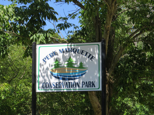
Pere Marquette Conservation park sign
Entrance sign at Pere Marquette Conservation Park (photo by jhy)

by Joan H. Young

In 2021, Pere Marquette Township (Mason County, MI) unveiled plans to develop 300 acres of property purchased from the former Dow Chemical site, on both sides of the Pere Marquette River.

The ambitious project includes trails, boat launches, picnic and restroom facilities. Interpretation, sports complexes and more are planned. A new boat launch opened in 2024 on the north side of the Pere Marquette River, just west of Oceana Drive (Old 31).

This round of funding will improve a park entry on Lakeshore Drive across from White Pine Village. There will be a new driveway with safer sight lines for exit. A 3/4-mile paved trail will extend from there to the Buttersville Campground. Better parking will be installed, and signs, lighting, etc.

These projects are proposed to be completed in 2026. The township board has recently approved to enter into a grant agreement with the Michigan DNR. The DNR will provide 48% of the funding: $400,000. This will be matched locally by $435,000 or 52%. This is the final step in accepting this grant money. Requests for proposals can now be made on the next phase of construction.

The master plan for the acreage is more on the scale of something a state might undertake rather than a township. In response to this comment, Supervisor Kelly Smith said, "Over time I think a lot of it will happen. We are working on grants-matching programs. I'm still exited about the expansion of the park as a whole. We are making headway on the things that were identified in the plan. We are also chipping away at projects with environmental restoration to native plants."
Pere Marquette Conservation accessible walkway
accessible walkway at Pere Marquette Conservation Park Community Access (photo by jhy)


The Community Access site on the north side of the river opened in 2024. It received heavy usage this year, and is an outstanding example of the quality of the plan and its execution that the township is following.

Call PM township 231-845-1277

See the PM Township Park Master Plan

See the Mason County Press article Pere Marquette Conservation Park holds grand opening

See a news article in the Ludington Daily News

These links are checked on the date of the article. As the article ages, some links may become invalid

Go To www.getoffthecouchnews.blogspot.com for all the news
See Get Off The Couch


Saturday, November 1, 2025

Old Grade Trail Needs Work

alt text
unnamed creek on Old Grade Trail (photo by jhy)

written by JHY

The Trail at Old Grade Campground Near Peacock Partially Obliterated

Just north of 4-Mile Road and the Little Manistee River in Lake County, MI, is the Old Grade Campground, within the Manistee National Forest. As a typical NF Campground, it is open from about mid-May until mid-October.

The campground is named for the fact that the main road is a former railroad grade. A portion of a logging spur of the Manistee and Luther Railroad ran east-west and crossed the river near the western end of the campground. This straight and level berm makes a great vehicular road.

On the north side of the road is a loop trail of about 1.7 miles. It is roughly triangular with a fairly straight leg up the east side. Then the trail turns west into the woods and loops back toward the campground road. The bottom leg of the triangle parallels the road to connect back to the start.

Currently, the east portion is wide and clear. There are occasional blue diamond blazes. The turn to the west is marked, but would be easy to miss. The treadway is not clear at all, and blazes are too far apart. Using electronic aid, I managed to find the narrow and unmaintained west side of the triangle. Most of it could be followed, but it would be a challenge for novice hikers. It re-enters the campground behind one of the vault toilets.

Worst of all, the southern portion that parallels the road is in terrible shape with many downed trees. This is unfortunate, since it's closest to the campsites and would be a nice walk for families.

The east leg can be hiked as an out-and-back. The west leg can easily be followed to where the small creek flows into the Little Manistee River without problem.

During the part of the year when the campground is closed and gated, you can park outside the gate and walk in, but this will add a quarter-mile to your hike in each direction.

The Forest Service has an investment in this trail with several bridges, and a number of interpretive signs. Hopefully, the treadway will be cleaned up in spring of 2026. Perhaps they would be willing to accept volunteer help for this endeavor.

The campground has numerous sites and latrines.

This site has not yet been added to the GOTC website. See Huron-Manistee Forest Old Grade Campground page

These links are checked on the date of the article. As the article ages, some links may become invalid

Go To www.getoffthecouchnews.blogspot.com for all the news
See Get Off The Couch


Monday, August 12, 2019

Should Eminent Domain be Reinstated?

trail in Nordhouse Dunes Wilderness
Off-road trail is a goal, but how can it be accomplished? (photo by jhy)

from a story in Outside

Jim Kern, founder of a new advocacy group called Hiking Trails for America, believes the only way to complete the National Trails System is by bringing back the ability to acquire land for trails by the use of eminent domain.

The only trail which ever had this authority was the Appalachian Trail, and there was so much backlash afterwards that the next several trails authorized (including the North Country Trail) were not only denied this tool, but they were banned from buying land. Only in recent years has Congress finally authorized the NCT to buy land, even from willing sellers.

Kern points out, “Every long, thin corridor that is important in America—a gas line, a railroad—[developers] wouldn’t think of doing it without eminent domain.”

Eminent domain for any purpose generally results in hard feelings and resentment. Amy Lindholm, who manages the Land and Water Conservation Fund Coalition replied to Kern. “I understand why you would advocate for eminent domain. It would certainly make things more expedient. But there just isn’t the political support for it.”

Currently, trails make their way across private land by means of handshake agreements, which are highly vulnerable to change, easements of various types, and outright purchase where possible.

If it were reasonable to think that trails could gain land by eminent domain, would it be worth the public backlash? Jim Kern believes it is the only way.


Like This!


See Hiking Trails for America
See The Controversial Plan to Protect America's Trails
These links are checked on the date of the article. As the article ages, some links may become invalid

Go To www.getoffthecouchnews.blogspot.com for all the news
See Get Off The Couch

Friday, February 19, 2010

Equestrian Trail Access Bill Passes MI Senate


OutdoorBlips: vote it up!
if you like this article, click the Blip chiclet!
based on a news article in the Spinal Column

If House Bill 4610 passes, it would be the last step in a process which will require the state Department of Natural Resources and Environment (DNRE) to restore access for horse riding to all state owned land that was open to that use on May 7, 2008. Existing trails must be kept open and accessible.

There has been a lot of question about how this will affect $25 million of federal funding. As originally written the federal wildlife and sportfish restoration funds would have been withheld from Michigan after passage. Language which includes management control standards must be added to the bill.

Compromise language which would accomplish this has been created by the Michigan United Conservation Clubs. Nine revisions of the bill were necessary before an acceptable version was found.

Spinal Column concludes, "As it stands now, the bills outline a process for trail closures by the DNRE and create an Equine Trail Advisory Council to help the DNRE identify additional trails that should be opened for access to equestrian trail riders."

The bill remains extremely controversial. Bicycle trail groups have expressed concern that trails they have built may be opened to horseback use, and some foot paths may be similarly affected.

See MUCC policy letter (a pdf)
These links are checked on the date of the article. As the article ages, some links may become invalid

Go To www.getoffthecouchnews.blogspot.com for all the news
See Get Off The Couch


Friday, October 3, 2008

Into the Woods - North Country Trail Near Petoskey

volunteers build benched trail,
taking the NCT off Krause Road
(photo credit Cora Killinger)


by Joan H. Young

Long (and short) distance hikers of the North Country Trail can rejoice this week as one more half-mile of trail has been taken off road, into the woods.

The new section of trail, just south of Petoskey, will connect two sections on city property. The project has been a long-time dream of property owners Doug and Pam Boor. For several years they have been working with the Nature Conservancy to sell a trail easement to the Conservancy. That transaction was completed this past year, and all that remained was to build the trail.

Saturday, September 27, over 45 people showed up to make that piece of trail a reality on the ground. The tasks were organized by Gary Johnson and Cora Killinger, of the Tittabawassee Chapter of the North Country Trail Association. This section of trail traverses a steep hillside, requiring that almost all of the trail be benched into the hill. This type of trail is difficult to build, requiring hard work, and close attention to detail to create a treadway that will stand up to hiking traffic. It is also very rewarding to view at the end of the day!

Cora reports that in this one day the work was about 80% completed. She says, "No one person could have done much, but together you should see what we've accomplished!"

viewing platform
and the view from the new trail
(photo credit Cora Killinger)
The hillside where this new trail is located is one of the highest spots in Emmett County. Thanks to the Nature Conservancy there is a viewing platform already in place from which you can see Little Traverse Bay. This is sure to become one of the favorite scenic views along the NCT.

Doug Boor's dream for the section includes creating a primitive campsite where hikers may stay.

It's only a short piece of trail, you say? Yes, but consider the many layers of complexity required to create it. A property owner, the city of Petoskey, the Nature Conservancy, the North Country Trail Association, finance sources, volunteers, and other individuals all worked together to make this a reality. When you ponder this effort it makes you appreciate the enormity of the vision to place all the miles of the NCT, New York to North Dakota, off road.

See North Country Trail
See The Nature Conservancy
These links are checked on the date of the article. As the article ages, some links may become invalid

Go To www.getoffthecouchnews.blogspot.com for all the news
See North Country Trail
See Get Off The Couch

Sunday, January 27, 2008

Sturgis Plans Bike Paths, Park Upgrades

Sturgis, Michigan, city commissioners have developed a list of five-year goals which include a community park, new children's playground equipment, biking and walking trails, a disc golf course, a new softball complex, a regional rails to trails program, and even a dog park.

Although this is a long term plan the city manager says that any progress that can be made toward the goal is good.

More than $50,000 could be spent in 2008 to develop a citywide sidewalk-bikepath master plan, to develop a master plan for Oaklawn Terrace Park improvements, and for Oaklawn Terrace Park Phase 1 parking improvements and roller hockey renovation.

Grants and land will need to be sought to bring all the ideas to reality.

from the Sturgis Journal, "Plan includes bike paths, park upgrades", by Terry Katz, Jan 24, 2008
These links are checked on the date of the article. As the article ages, some links may become invalid

Go To www.getoffthecouchnews.blogspot.com for all the news
See Get Off The Couch

Friday, January 18, 2008

Kent County Townships Plan For More Trails

Byron and Gaines townships are targeting improvements along Division Avenue, between 60th and 84th streets.

Over the next 20 years, more than $2.4 million in improvements in the corridor are projected. Each township has established a Corridor Improvement Authority for the locale. A 60-day waiting period is in place, during which time governmental units collecting taxes from the townships - Kent County, Kent District Library and Grand Rapids Community College - can opt out.

The improvement plan could be approved this spring. Improvements are planned for the streetscape, sidewalks, non-motorized trails, parking, public transportation, storefronts, signage and parks.

from the Grand Rapids Press, "News Briefs", Jan 17, 2008- see FAIR USE notice.
These links are checked on the date of the article. As the article ages, some links may become invalid

Go To www.getoffthecouchnews.blogspot.com for all the news
See Get Off The Couch

Thursday, July 19, 2007

Non-Motorized Transportation Wish Lists

MDOT facilitates a Northwest Michigan Regional Non-Motorized Transportation Plan and Investment Strategy
MDOT alternate transportation meeting
participants study a map for trail opportunities
left- Patty O'Donnell of NWMCOG; center- Jim Clark, Lake County Commissioner, right- Les Russell, National Forest Service
Michigan Department of Transportation has identified northwest Michigan as an area ready to develop non-motorized transportation possibilities. They seek development of a comprehensive plan and identification of priority projects.

In other words, MDOT wants to help build and connect trails. Trails as transportation corridors can include uses such as hiking, bicycling, skiing, rollerblading, horseback riding, etc. Not all trails have to be multi-use, but they must be non-motorized to be included in this plan. The pool of funds available to build trails requires that the trails funded have connections which allow it to serve as a transportation corridor. For example, children might use this path to walk or ride bikes to school.

This week, Patty O'Donnell, the Regional Planner for the Northwest Michigan Council of Governments, met on separate occasions with representatives from Manistee, Mason and Lake Counties. At each meeting the individuals pored over a large county map which showed available trails. People were then encouraged to wield colored markers and use their imaginations to dream and mark up the map with a wish list of non-motorized trail connections.

There were 12 local representatives, mostly from the various townships, who participated in the Mason County meeting. High on their wish list was extension of the Hart-Montague Rail Trail to Ludington, and making it possible to bicycle safely from downtown Ludington to Scottville, and to West Shore Community College.

At the Lake County meeting District 6 Commissioner, Jim Clark, and Les Russell of the Manistee National Forest dreamed of providing more trails within the National Forest, and extending the Pere Marquette Rail Trail of Mid-Michigan west from Baldwin.

The Northwest Michigan Council of Governments (NWMCOG) will take this information and prepare for and host educational meetings with the public to document interest in these projects, and it will then prepare for and facilitate a regional Trails Summit.

The NWMCOG includes Antrim, Benzie, Charlevoix, Emmet, Grand Traverse, Kalkaska, Lake, Leelenau, Manistee, Mason, Missaukee, Osceola, and Wexford Counties.

Funding for projects will come from Transportation Enhancement money. These funds are now known as SAFETEA-LU. Not all trail projects are eligible to use these funds, but many are, and better use of this resource would enhance recreation throughout the area.

by Joan H. Young
See Northwest Michigan Council of Governments
learn more about Transportation Enhancement money at American Hiking Society
Contact Patty O'Donnell, Regional Planner, Northwest Michigan Council of Governments
These links are checked on the date of the article. As the article ages, some links may become invalid

Go To www.getoffthecouchnews.blogspot.com for all the news
See Mason County
See Lake County